|
||
|
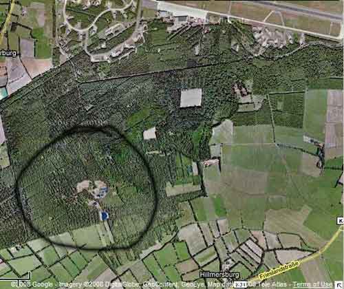
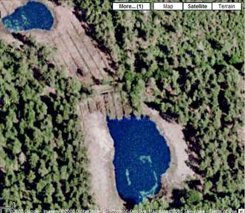
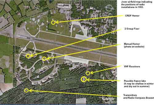
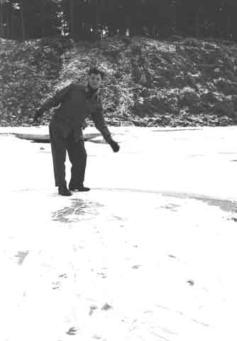
Here we are out on a lake in the middle of the forest that goes round from the south to the east of the airfield and not far from the building where the VHF receivers were kept. As we were only about 8 feet above sea level the underlying soil was sand and the water table sinks in the winter when the surface is frozen causing the ice to crack around the edge of the lake and collapse back into the water. YoursTruly On Ice. This is me trying to maintain equilibrium. The lake must have formed at the bottom of a quarry as you can see that the sides are about 20 feet high and we are probably below sea level here! - Feb54. Subsequent photographs show that this was the assault course.
Maurice Parker has come up with a most likely explanation. He writes: "Dick seems to be on the right track in regard to where this small lake was. A relation of mine was a GSO man and a GAF civilian dog handler and he tells me that there used to be a lake in the area were Dick has indicated on his map. He also said that in 1961 when the RAF were preparing to hand over the station to the GAF, all surplus equipment was dumped here and the the lake was then filled in with earth. This could then possibly account for the none existance today. Dick must then be refering to the area he describes as possible frozen lake." (Thanks to Dick Endecott and Maurice Parker) |
||