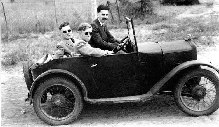
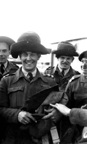
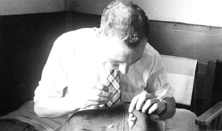
Bebe Sharman was a charismatic individual with a tremendous sense of humour. He was responsible for all the amusing history and background to the Jever Steam Laundry. These pages are dedicated to his life in the RAF and his sense of humour. He was a professional photographer having joined the RAF originally as an airman in the photographic branch. We are grateful to Mamie Sharman, his widow, who has kindly given us his five photo albums to load on to the web site in his memory.
The Five Albums, (a total of 761 photos), are as follows (Click on the green title to jump to that album):
Album 1 - January 1948 to November 1948 RAF Luqa, Malta - 198 photos.
Album 2 November 1948 to February 1951 RAF Luqa, Malta, Castel Benito, Libya, RAF Jurby, Isle of Man, flying training at RAF Heany in Northern Rhodesia - 214 photos.
Album 3 - February to November 1951 Flying Training in Rhodesia - 139 photos.
Album 4 - December 1952 to March 1955 Venoms at Fassberg and Hunters at Jever- 120 photos.
Album 5 - December 1955 to July 1966 Hunters at Jever and civilian life - 90 photos.
We continue with Album 3 covering the period of his flying training in Rhodesia from February 1951 to November 1951.
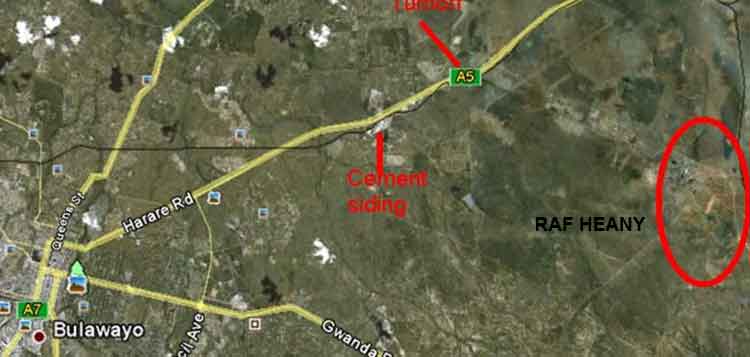
Location of RAF Heany in relation to Bulawayo, Zimbabwe today, Southern Rhodesia then.
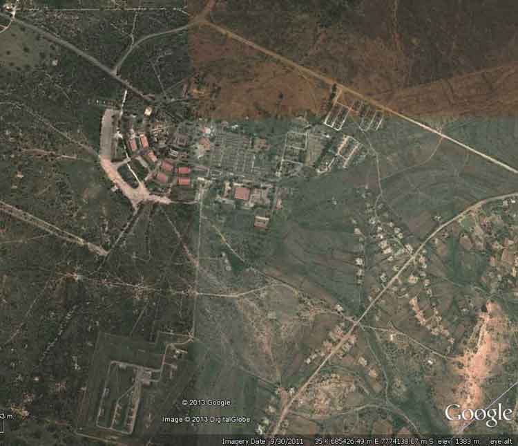
Ex-RAF Heany as at 31Jan2012. (Thanks to Goggle Earth.) The following story is told by Rusty Theobald on the "Our Story" web site and gives a good description of RAF Heany about a year after the time that BeBe was in training there:
Story No. 68 By Rusty Theobald
I arrived at RAF Heany,
RATG (Royal Airforce Training Group) January 1953, in an airforce blue Bedford bus after landing at Kumalo in a
CAA Viking aircraft. We had flown down to Livingstone Northern Rhodesia from England in a Skywork
Avro York, the whole trip, Lyneham, Malta, Benghazi, Khartoum, Entebbe, Livingstone had taken five days.
Kumalo No. 3
FTS (Flying Training School) was just outside Bulawayo on the road to Gwelo.
Heany No. 5
FTS was eighteen miles outside Bulawayo on the same road. Turning right at Heany (rail) Junction would take you straight into RAF Heany. This dusty track of concrete strips was about 1 to 2 miles long.
RAF Thornhill was No. 4
FTS and was 100 miles from Bulawayo using the Gwelo road.
Heany was a very large station, we were housed in corrugated iron huts with 25 men in each one, 24 in the dormitory with one corporal in the bunk room at one end. This meant that any hut could raise a football team in no time if a challenge was thrown down. There were eight huts in a row numbered 1 to 8 and as far as I can remember there were about six rows lettered A to F making well over 1,000 single men. Then there were the married families in their married quarters and close by the officers and student pilots. The airfield was guarded and served by the
RAR (Rhodesian African Rifles) and they had a camp of their own adjacent to the RAF station. I do not recall having to do duty crew but we did have to carry out guard duties around the air base, the married patch and the officer's area. This we did in pairs, one RAF member and one RAR member with a torch, a truncheon and a whistle. Two hours on and four hours off, meaning two spells of duty through the night. The whistle was always given to the African because we were not sure who had been blowing it before, they did not seem to mind. The truncheon and torch we carried so that we could shine the torch quickly when we heard a scary noise, there were few street lights. The whistle and it's custodian would be long gone at the sound of anything scary. So being left on your own, the truncheon gave one a fighting chance.
Heany had a small church which was used mostly by the Africans, a very splendid swimming pool with a small gymnasium, at least two football fields, a rugby field, a
NAAFI club, a pub called 'The Constable Arms', a canteen shop near our billets where I used to buy a tin of pears and a king size tub of ice cream for one shilling and sixpence, (At prices Jul2013=£1.81),, a lovely treat once a month. We also had a cinema which was a large converted hangar just behind the guard room. I only went into Bulawayo to watch football matches when there were free airforce buses doing the run. The captain of the Rhodesian team at the time was an RAF Heany member 'Corporal Austin'. I could not go into town more often because I was only paid £5.00, (At prices Jul2013=£120.41), every two weeks. The first part of the flying training course was carried out in
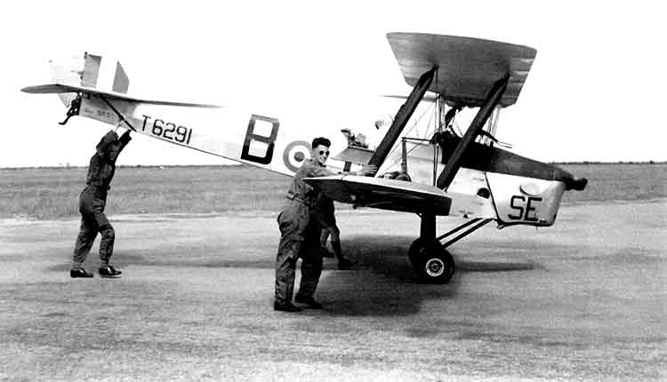
Chipmunk aircraft of No. 1 Squadron, (was
Tiger Moths during
BeBe's time), and the second part using Harvards of No. 2 Squadron. We also had an
Anson named 'Moava'. I managed to get on two trips to the Victoria Falls, firstly in the
Anson and the second time in a Harvard. (Thanks to Rusty Theobald.)
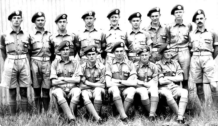
I presume this is the 14 members of BeBe's flying training course at RAF Heany, Rhodesia in February 1951. BeBe is 2nd from left in the back row.
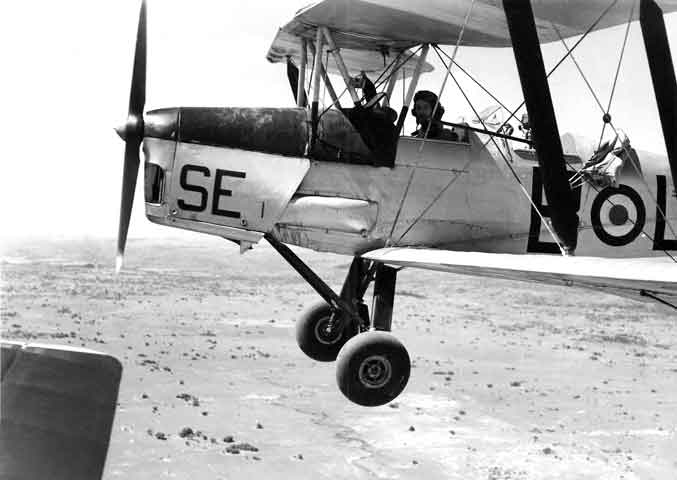
Tight Formation in a Tiger Moth.
Garratt Type 15A "Rhodesian Type" engine at Heany Junction.
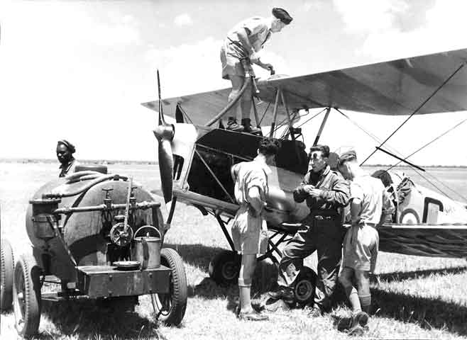
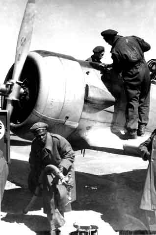
Informal shot taken at "B" Flight refuelling Taff's Tiger Moth.
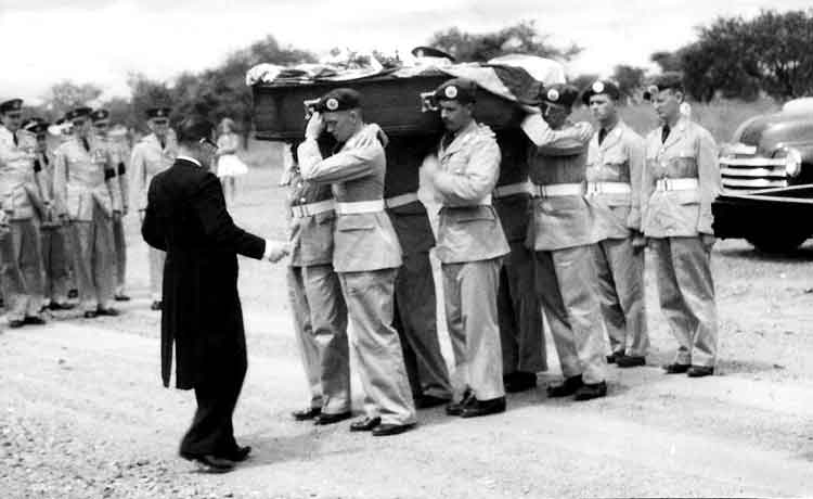
Brian Penney's funeral on 15Jan51 - "One of the boys". On Saturday 13Jan51 Brian Penney was sent on hist first solo flight in Tiger Moth T.2 T6524 at 4 FTS at RAF Heany, Southern Rhodesia. Immediately after take-off the aircraft entered a spin and crashed into the ground killing Brian. (Thanks to Colin Cummings record of RAF accidents "Last Takeoff")
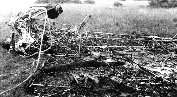
What was left of Brian Penney's Tiger Moth T.2 T6524.
Prophetic doodle by Brian Penney found after his crash.
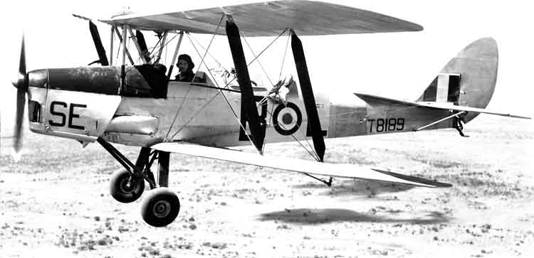
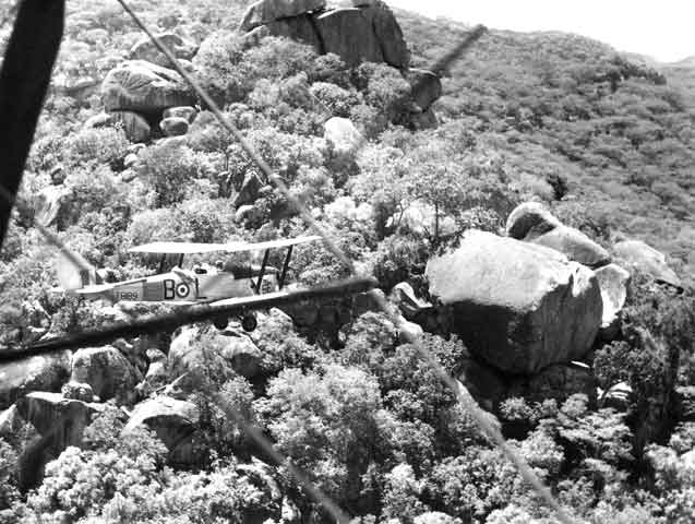
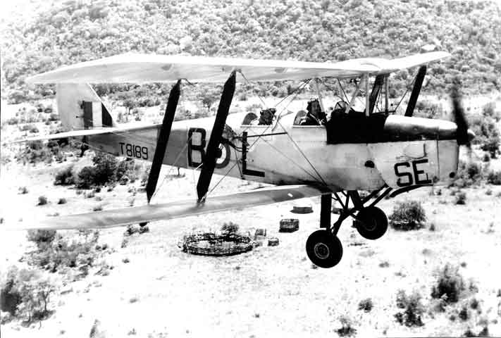
Tiger Moth T.2 from 4 FTS - T8189.
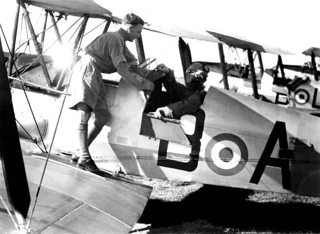
"...and don't knock the undercarriage of this one!" BeBe gets a briefing from his instructor.
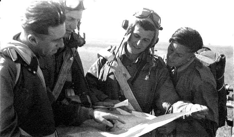
"Now, this was where I got lost!" B Flight, 4 FTS, Basic Tiger Moth students share experiences.
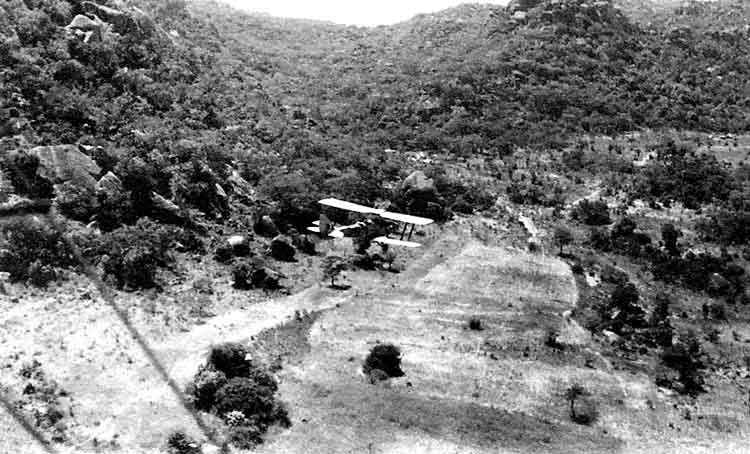
The entrance to "Wilson's" gorge.
Paddy Mulrooney down in "Wilson's" Gorge.
Native Kraal from the air. A Tiger Moth flew in front of the camera just as BeBe exposed - so he says!
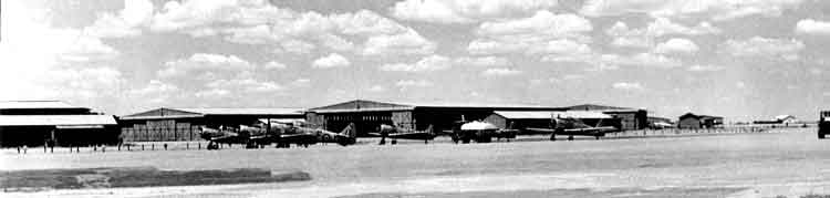
A view of No. 4 FTS Heany. The curve of a double row of hangers appears to be still there in the photo above.
Frank, Ginge and Doug in the "Thing".
A sample of the behaviour at Heany. BeBe in a sandwich.
Fred Smith, blind, lame and with no teeth - ("I'm not fit to be a pilot!").
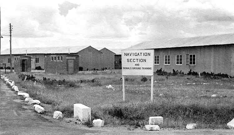
Where the Nav Section's sign is usually found....
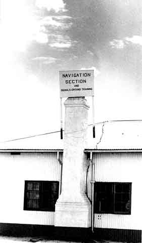
....and where it appeared after a party in 2 Mess.
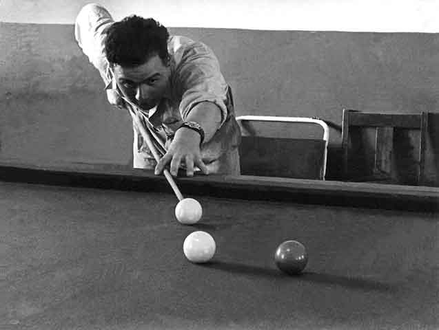
BeBe playing billiards in the Old Mess.
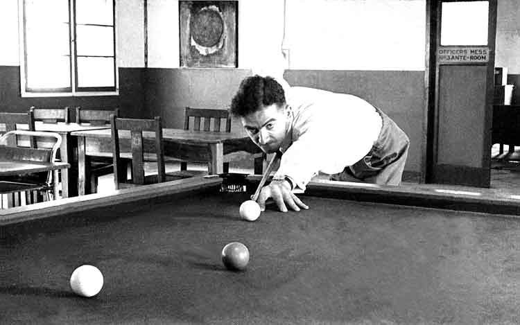
BeBe's opponent.
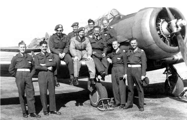
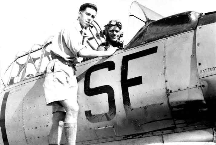
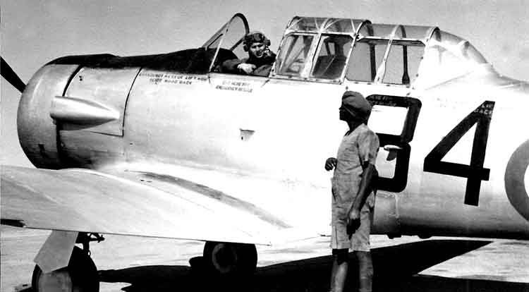
The Course in front of a Harvard. L to R: Driscoll, Stokes, Warner, Flt Sgt Gapper, Stockley, Flt Sgt Hicks, Sgt Unknown, Reeve, Dood and BeBe Sharman.
The day 13 Course got their wings!
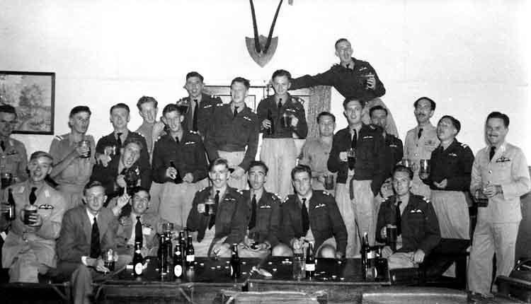
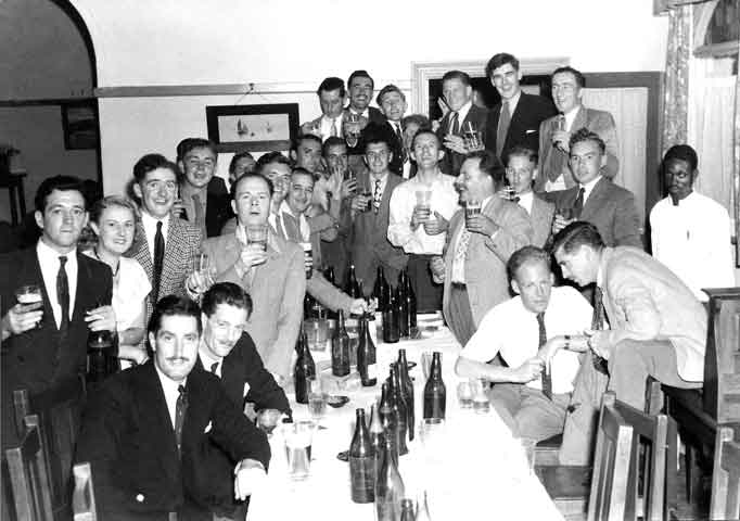
13 Course Party at Essexvale.
Specimens from 16 Course.
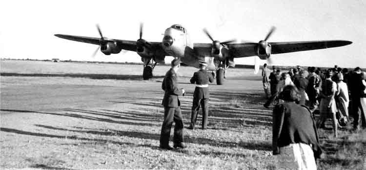
Empire Day - the visiting Lancaster - 24May51.
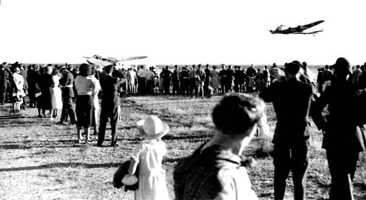
Crowds, Lancaster and the de Havilland Dominie - Empire Day 24May51.
Dispersal- Empire Day 24May51.
No tractors needed here.
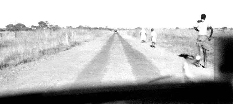
The "Strips" - Rhodesian Grade 'A' Roads.
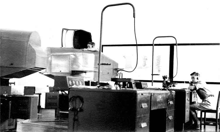
Where hours of misery are spent - Link Section at Heany.
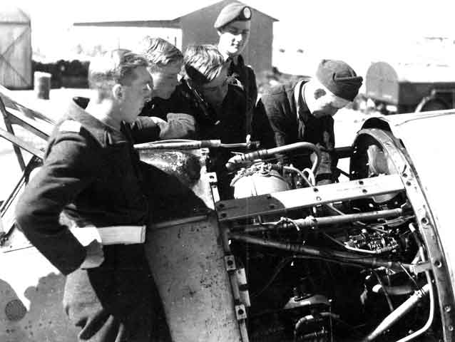
"E" Flight cadets appear to take an interest in a Fitter's job L to R: Kortens, Bridson, Copeman and Godsil Ltd.
16 Course end of Tiger Moth party.
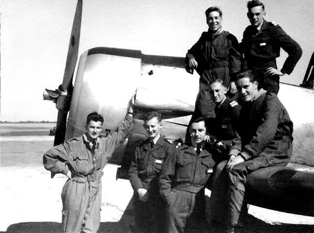
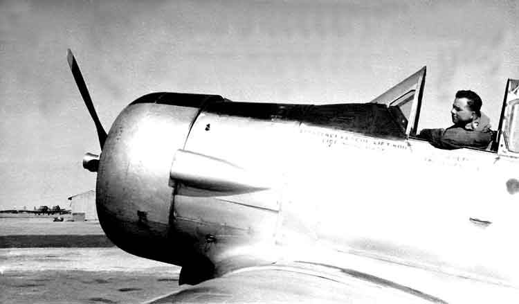
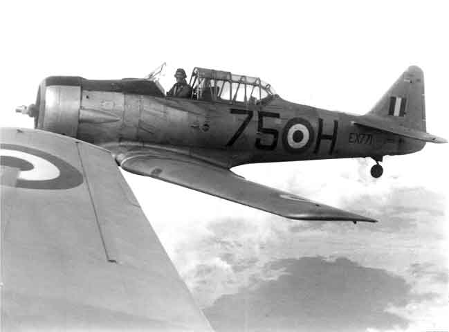
We start to fly Harvards in 'D' Flight - Fitter and BeBe.
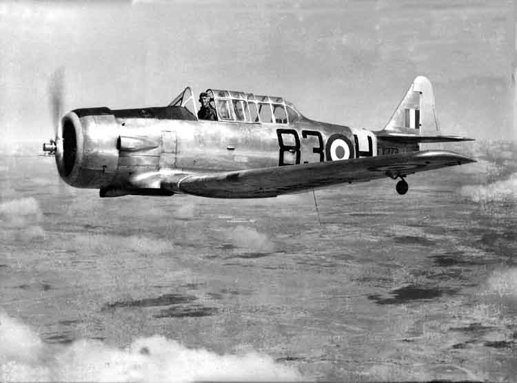
North American AT-6 Harvard
The AT-6 Texan, (known as the Harvard in the RAF), was designed in the late 1930s as a low-cost advanced trainer with the handling characteristics of a high-speed fighter, and was developed from the fixed undercarriage BC-1 combat trainer produced for the USAAC in 1933. The first production AT-6 appeared in 1940 and was followed in 1941 by the AT-6A (US Navy SNJ-3), 1,549 of which were built. The AT-6B was similar, but intended for gunnery training; the AT-6C (SNJ-4) had structural modifications to save on aluminium. 2,970 were built. The major production version of the type was the AT-6D (SNJ-5), 4,388 of which were produced, while the last variant was the more powerful AT-6F (965 built). Around 15,000 Texans were produced in total, some 5,000 of which went to the RAF and Commonwealth air forces. The type was also produced under licence in Australia, Canada and Sweden. Specifications apply to the AT-6A: Crew: 2; Powerplant: one 448 KW (600 hp) Pratt & Whitney R-1340-49 Wasp 9-cylinder radial engine; Performance: max speed 335 Km/h (208 mph); range 1,205 Km (750 miles) service ceiling 7,325 m (24,300 ft) Dimensions: wingspan 12.80 m(42 ft); length 8.84 m (29 ft); height 3.55 m (11 ft 9 in). Weight: 2,404 Kg (5,360 lb) loaded. Armament: two 7.62 mm (0.30 in) machine guns. (Thanks to The Encyclopedia of Aircraft edited by Robert Jackson).
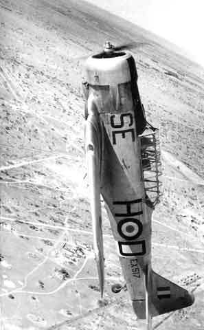
Empire Day at RAF Heany May 24th 1951 - Formation aerobatics - North American Harvard EX517. Thanks to Keith Wilson-Clark who researched the RAF Heany Operations Record Book (ORB) for May 1951 at the National Archives at Kew, we now know that the execution of the display on 24May51 was as follows: Rehearsals were held on 3rd and 19May51. In the ORB is a copy of the Operations Order No. 1/51. There was solo Harvard aerobatics on demand by Flt Lt Lancombe and Flt Lt Hindle who took it in turns to perform. There was a display by three Tiger Moths that were tied together and performed loops and turns - Flt Lt Coulthard, Master Pilot Mulrooney and Flt Sgt Wilson. Nine Harvards demonstrated formation changes in level flight. Four Harvards then flew Box, Line Astern, Line Abreast, Arrowhead, formation loops in box, line astern, Vic, formation barrel roll in line astern, then a tailchase and a formation landing. This was carried out by Flt Lt Ashworth (as recorded in BeBe's album caption to the next photo), Flt Lt Peterson, Flt Lt Steinbach and Flt Lt Young. There were a couple of other items as well. Keith's research showed that it was intended to do it again on 24May52 but was cancelled on 16May52 due to 'the American fuel strike'. Nothing mentioned in 1953 so this was probably the last Empire Day Air Display at RAF Heany.
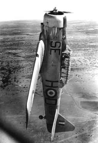
Going Up? - Harvard EX517 in formation loop - Empire Air Day Flt Lt Ashworth pilot.
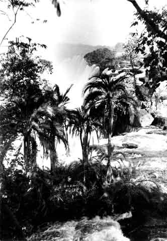
VICTORIA FALLS, RHODESIA
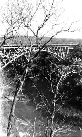
Victoria Falls Bridge that crosses from Southern to Northern Rhodesia.
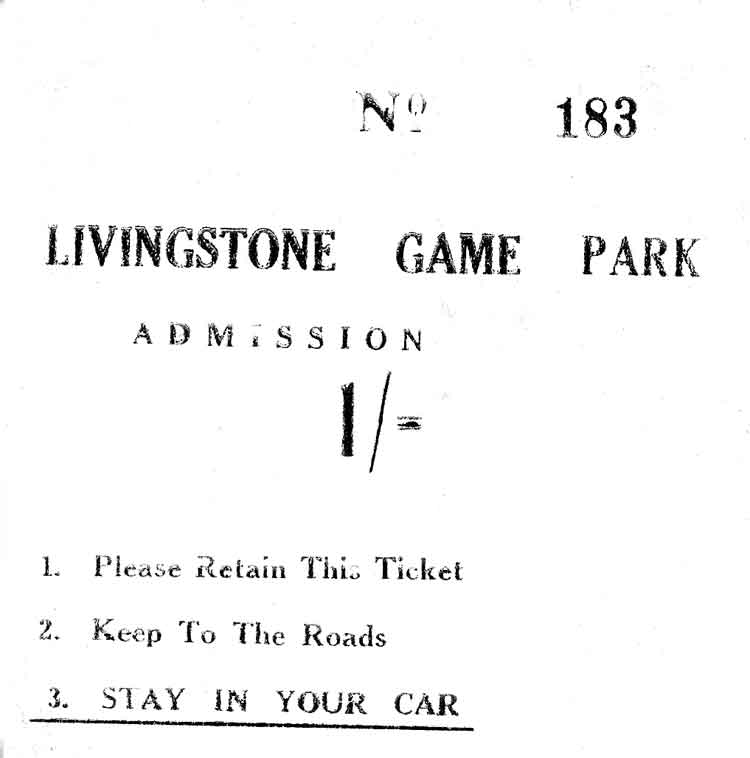
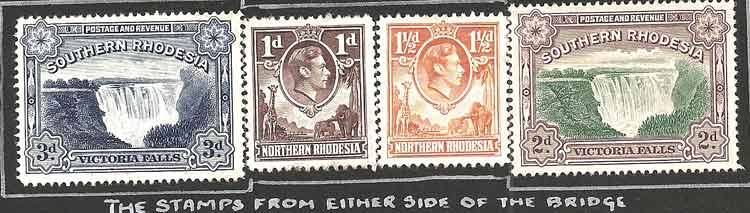
BeBe crossed the Victoria Falls and visited the Livingstone Game Park. He bought some stamps from the other side. Mosi-oa-Tunya National Park is an UNESCO World Heritage site that is home to one half of the Mosi-oa-Tunya - 'The Smoke Which Thunders' - known worldwide as Victoria Falls on the Zambezi River. The river forms the border between Zambia and Zimbabwe, so the falls are shared by the two countries, and the park is 'twin' to the Victoria Falls National Park on the Zimbabwean side. Mosi-oa-Tunya National Park covers 66 sq km (25 sq mi) from the Songwe Gorge below the falls in a north-west arc along about 20 km of the Zambian river bank. It forms the south-western boundary of the city of Livingstone and has two main sections, each with separate entrances: a wildlife park at its north-western end, and the land adjacent to the immense and awe-inspiring Victoria Falls, which in the rainy season is the world's largest curtain of falling water. It extends downstream from the falls and to the south-east along the Batoka Gorges. (Thanks to Wikipedia).
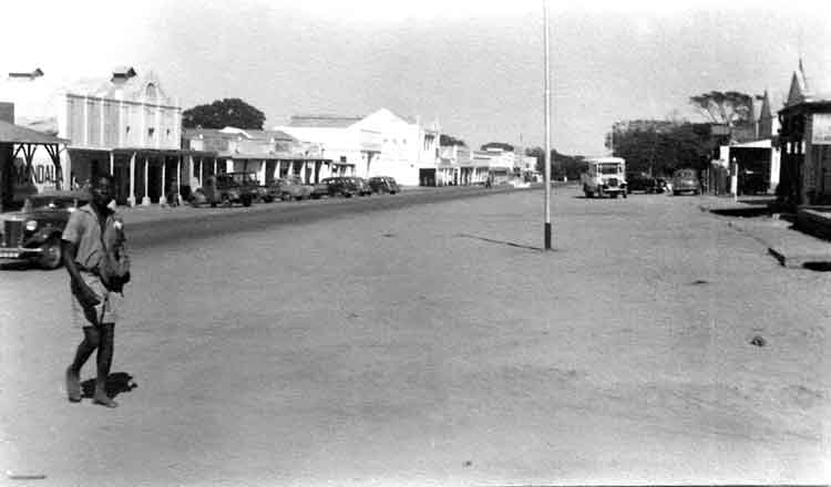
Almost the whole of Livingstone, Northern Rhodesia.
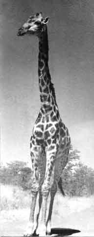
A denizen of Livingston Game Park that you did not need to leave your car to see.
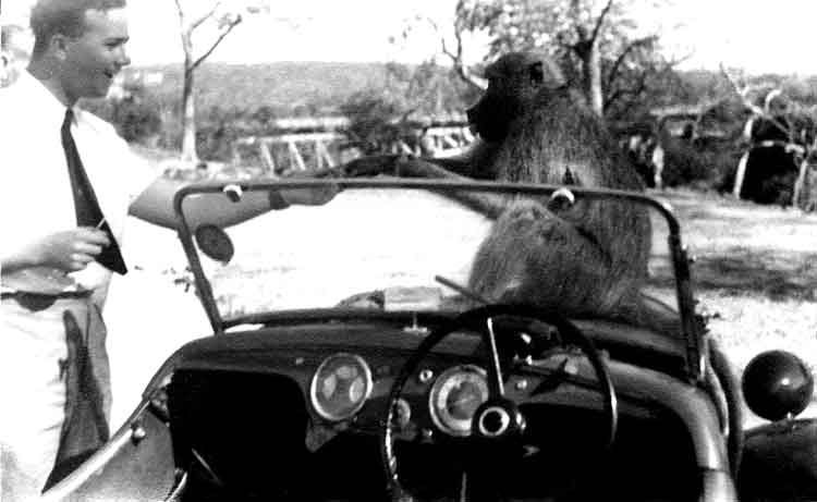
The baboons around here are far from shy! He obviously did not read his ticket! The wildlife park includes tall riverine forest with palm trees, miombo woodland and grassland with plenty of birds, and animals including giraffe, zebra, warthog, sable, eland, buffalo, impala and other antelope. Animal numbers fell in droughts over the last two decades. The park contained two white rhino which are not indigenous and were imported from South Africa - they were both poached during the night of June 6, 2007. One was shot dead and dehorned not far from the gate and the other received serious bullet wounds but has triumphed against all odds and still lives in the park under twenty four hours surveillance. As of June, 2009 the number of white Rhino in the park has been increased to five animals with plans to introduce further animals in due course. The indigenous (black rhino) was believed extinct in Zambia but has recently been reintroduced in a pilot area). Elephants are sometimes seen in the park when they cross the river in the dry season from the Zimbabwean side. Hippopotamus and crocodile can be seen from the river bank. Vervet monkeys and baboons are common as they are in the rest of the national park outside the wildlife section. As of January 2009 the commercial wildlife company, Lion Encounter, has been operating a "walking with Lions" experience within the park, with further plans to start a breeding programme for lions within the soon to be expanded Dambwa Forest section of the park. Within the wildlife park is the Old Drift cemetery where the first European settlers were buried. They made camp by the river, but kept succumbing to a strange and fatal illness. They blamed the yellow/green-barked 'Fever Trees' for this incurable malady, while all the time it was the malarial mosquito causing their demise. Before long the community moved to higher ground and the town of Livingstone emerged.
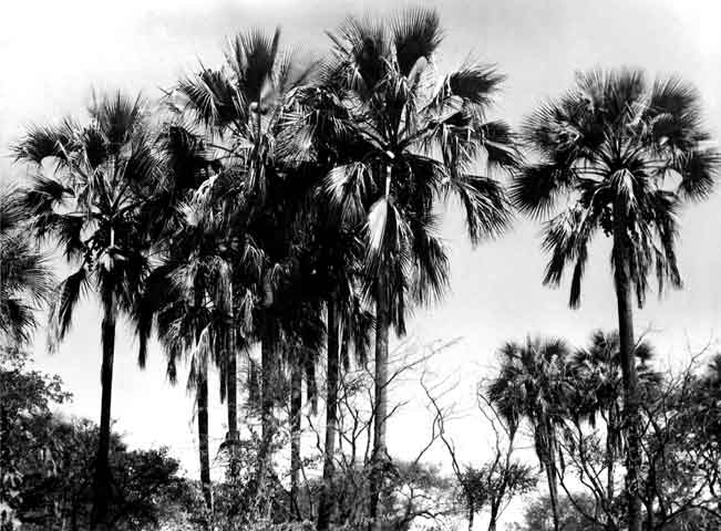
"Majestic Palms" Zambesi.
The edge of Victoria Falls. The recent geological history of Victoria Falls can be seen in the form of the gorges below the falls. The basalt plateau over which the Upper Zambezi flows has many large cracks filled with weaker sandstone. In the area of the current falls the largest cracks run roughly east to west (some run nearly north-east to south-west), with smaller north-south cracks connecting them. Over at least 100,000 years, the falls have been receding upstream through the Batoka Gorges, eroding the sandstone-filled cracks to form the gorges. The river's course in the current vicinity of the falls is north to south, so it opens up the large east-west cracks across its full width, then it cuts back through a short north-south crack to the next east-west one. The river has fallen in different eras into different chasms which now form a series of sharply zig-zagging gorges downstream from the falls. Apart from some dry sections, the Second to Fifth and the Songwe Gorges each represents a past site of the falls at a time when they fell into one long straight chasm as they do now. Their sizes indicate that we are not living in the age of the widest-ever falls. The falls have already started cutting back the next major gorge, at the dip in one side of the "Devil's Cataract" (also known as "Leaping Waters") section of the falls. This is not actually a north-south crack, but a large east-northeast line of weakness across the river, where the next full-width falls will eventually form. (Thanks to Wikipedia).
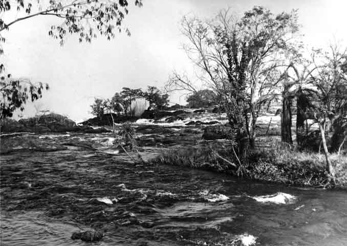
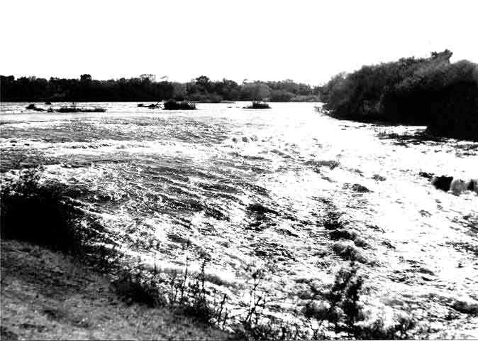
Another view of where the water 'topples' - Victoria Falls, Rhodesia, July 1951. The falls are formed as the full width of the river plummets in a single vertical drop into a transverse chasm 1708 metres (5604 ft) wide, carved by its waters along a fracture zone in the basalt plateau. The depth of the chasm, called the First Gorge, varies from 80 metres (260 ft) at its western end to 108 metres (354 ft) in the centre. The only outlet to the First Gorge is a 110 metres (360 ft) wide gap about two-thirds of the way across the width of the falls from the western end, through which the whole volume of the river pours into the Victoria Falls gorges. There are two islands on the crest of the falls that are large enough to divide the curtain of water even at full flood: Boaruka Island (or Cataract Island) near the western bank, and Livingstone Island near the middle-the point from which Livingstone first viewed the falls. At less than full flood, additional islets divide the curtain of water into separate parallel streams. The main streams are named, in order from Zimbabwe (west) to Zambia (east): Devil's Cataract (called Leaping Water by some), Main Falls, Rainbow Falls (the highest) and the Eastern Cataract. The Zambezi river, upstream from the falls, experiences a rainy season from late November to early April, and a dry season the rest of the year. The river's annual flood season is February to May with a peak in April. The spray from the falls typically rises to a height of over 400 metres (1,300 ft), and sometimes even twice as high, and is visible from up to 48 km (30 mi) away. At full moon, a "moonbow" can be seen in the spray instead of the usual daylight rainbow. During the flood season, however, it is impossible to see the foot of the falls and most of its face, and the walks along the cliff opposite it are in a constant shower and shrouded in mist. Close to the edge of the cliff, spray shoots upward like inverted rain, especially at Zambia's Knife-Edge Bridge. (Thanks to Wikipedia).
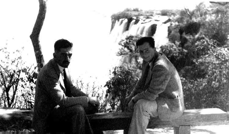
Photo taken purely for background - BeBe on the right.
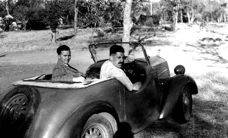
BeBe on the left in the bus that took them 600 miles. He doesn't say who the driver was but he looks like Stokes in the picture above in front of the Harvard. Note the tent in the background - I wonder if they camped?
Baobab Tree Limpopo June 1951. Adansonia is a genus of eight species of tree, six native to Madagascar, one native to mainland Africa and the Arabian Peninsula and one to Australia. The mainland African species also occurs on Madagascar, but it is not a native of that island, and was introduced in ancient times to south Asia and during the colonial era to the Caribbean. A ninth species was identified in 2012, incorporating upland populations of southern and eastern Africa. A typical common name is baobab. Other common names include boab, boaboa, tabaldi, bottle tree, upside-down tree, monkey bread tree or imbondeiro. The generic name honours Michel Adanson, the French naturalist and explorer who described Adansonia digitata.
Adansonias reach heights of 5 to 30 m (16 to 98 ft) and have trunk diameters of 7 to 11 m (23 to 36 ft). Glencoe baobab - an African baobab specimen in Limpopo Province, South Africa, often considered the largest example alive - up to recent times had a circumference of 47 m (154 ft). Its diameter is estimated at about 15.9 m (52 ft). Recently the tree split up into two parts and it is possible that the stoutest tree now is Sunland baobab, also in South Africa. The diameter of this tree is 10.64 m (34.9 ft), with an approximate circumference of 33.4 m (110 ft). Some baobabs are reputed to be many thousands of years old, which is difficult to verify, as the wood does not produce annual growth rings, though radiocarbon dating may be able to provide age data. (Thanks to Wikipedia).
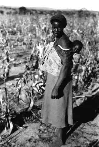
Maidamealies.
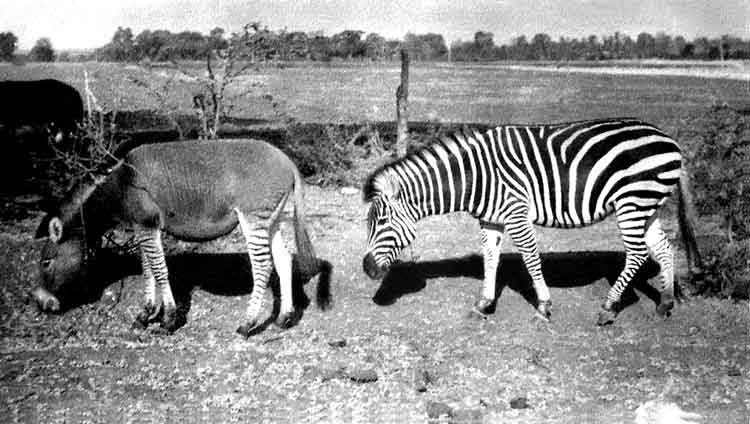
Female Zebra and Male Donkey - July 1951.
Zambesi River, early morning. The Zambezi is the fourth-longest river in Africa, and the largest flowing into the Indian Ocean from Africa. The area of its basin is 1,390,000 square kilometres (540,000 sq mi), slightly less than half that of the Nile. The 2,574-kilometre-long river (1,599 mi) has its source in Zambia and flows through eastern Angola, along the eastern border of Namibia and the northern border of Botswana, then along the border between Zambia and Zimbabwe to Mozambique, where it crosses that country to empty into the Indian Ocean. The Zambezi's most noted feature is Victoria Falls. Other notable falls include the Chavuma Falls at the border between Zambia and Angola, and Ngonye Falls, near Sioma in Western Zambia. There are two main sources of hydroelectric power on the river, the Kariba Dam, which provides power to Zambia and Zimbabwe, and the Cahora Bassa Dam in Mozambique, which provides power to Mozambique and South Africa. There is also a smaller power station at Victoria Falls. (Thanks to Wikipedia).
DURBAN, SOUTH AFRICA
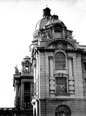
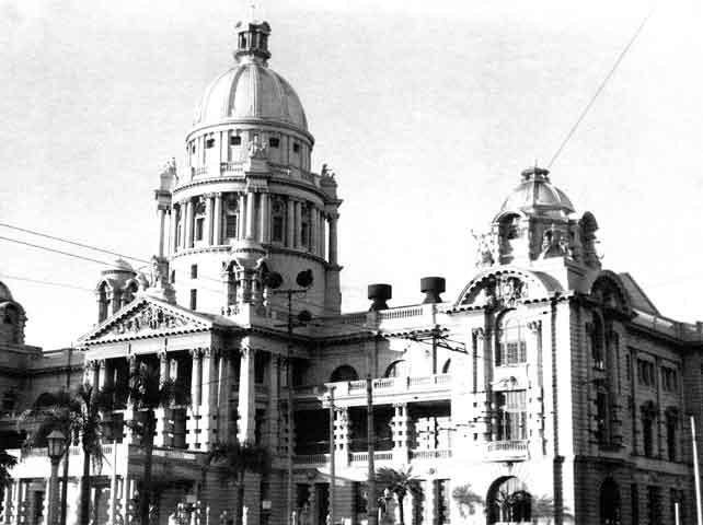
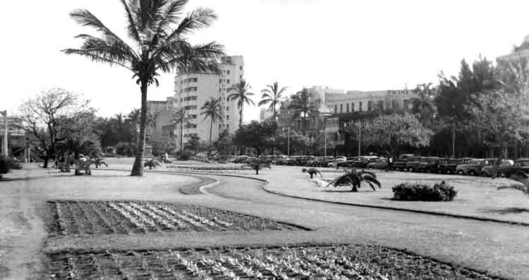
Durban City Hall - June 1951 Durban is the largest city in the South African province of KwaZulu-Natal. It is also the second most important manufacturing hub in South Africa after Johannesburg. It forms part of the eThekwini metropolitan municipality. Durban is famous for being the busiest port in South Africa and Africa. It is also seen as one of the major centres of tourism because of the city's warm subtropical climate and extensive beaches. The municipality, which includes neighbouring towns, has a population of almost 3.5 million, making the combined municipality the biggest city on the east coast of the African continent. The metropolitan land area of 2,292 square kilometres (885 sq mi) is comparatively larger than other South African cities, resulting in a somewhat lower population density of 1,513 /sq km (3,920 /sq mi). (Thanks to Wikipedia).
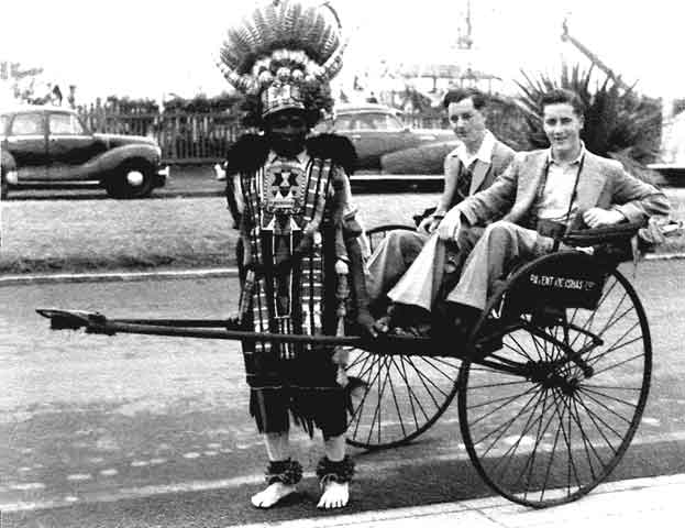
Bill and John take a cab in Durban. Durban is famous for its iconic Zulu rickshaw pullers navigating throughout the city. These colorful characters are famous for their giant, vibrant hats and costumes. There were about 2,000 registered men who pulled rickshaws in Durban in 1904; Since displaced by motorised transport, there are approximately 25 rickshaws left whom mostly cater to tourists today. (Thanks to Wikipedia).
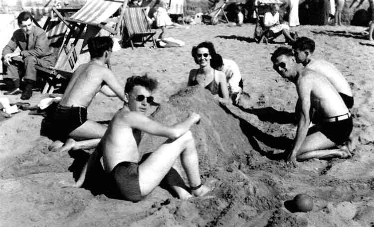
On the beach - 16 Course gets organised! The Golden Mile (or, colloquially, "The Mile") is the popular stretch of beachfront in the city of Durban, KwaZulu-Natal, South Africa, including the promenade that runs along with it. It runs roughly from South Beach (where the uShaka Marine World is located) to Suncoast Casino and Entertainment World in the north. It abuts the central business district of the city to its west. It is one of the main tourist attractions in the Durban area. The wide stretch of golden sands, artificially separated by various piers, provides excellent opportunities for sun-worshippers and swimmers to enjoy the sub-tropical sunshine and warm waters of the Indian Ocean. Most of the Mile's beaches are protected year-round by lifeguards and shark nets. The Mile is also a well-known surfer's haven. The South Beach end, in particular, is well known as a safe beach for neophyte surfers. The beachfront properties are a mix of residential apartments and tourist hotels, development of which boomed in the 1970s, although remnants of Durban's art-deco architecture are still evident. Interspersed among the beachfront properties are several popular restaurants and nightclubs. (Thanks to Wikipedia).
The City Hall - Durban.
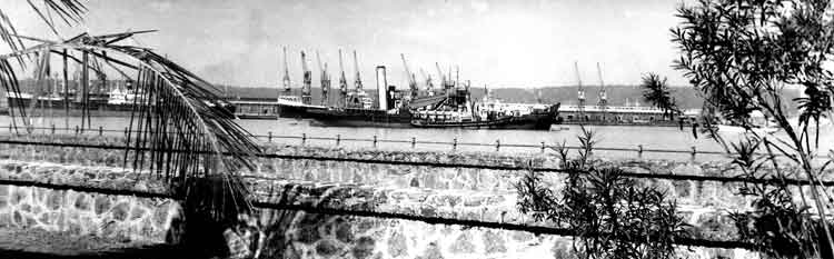
View towards the dock in Durban. The idea of Durban as a port dates back to 1824 when the first European settlers made a landing with the intention of setting up a trading post. The Bay of Natal (Durban Bay) was one of the few natural harbours available along the east coast of southern Africa between Algoa Bay and Delagoa Bay (now Maputo Bay). Vasco da Gama is said to have sighted the Bay on Christmas Day, 1497, when he hove to off the Bluff with his three small ships San Gabriel, San Raphael and Berrio, before naming the land Natal as a mark of respect for the Nativity. However subsequent studies by Professor Eric Axelson have suggested da Gama's 'discovery' was actually further south in the region of the present Port St Johns. A later paper by Brian Stuckenberg, director emeritus of the Natal Museum and an entomologist by training, undertook extensive research into certain aspects of the Portuguese voyages of discovery and concluded that da Gama was indeed off the present KwaZulu Natal coast on Christmas Day 1497.
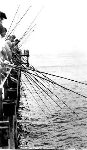
A fishing competition was taking place off Durban Pier.
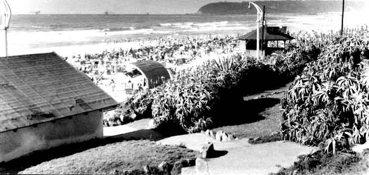
The "Shark Free" area of Durban Beach. For close to 40 years, South Africa's Natal Sharks Board (NSB) has been protecting swimmers against shark attacks. In the last several years, the agency has added protecting marine life, including sharks, to its mandate. Miles of protective netting were installed at resorts along a 200-mile (320-kilometer) stretch of the KwaZulu Natal province's coastline after a series of shark attacks in the 1950s and 1960s. The netting protected tourists at the popular coastal resorts, but scientists discovered that a disturbing number of sharks, (many of them harmless), stingrays, turtles, and dolphins were also being caught. "There needs to be a balance between safeguarding tourists and limiting harm especially to non-targeted marine life," said Jeff Gaisford, spokesman for KZN Wildlife, the province's nature conservation and ecotourism authority. (Thanks to National Geographic News.)
The gardens along the front in Durban.
The valley of a Thousand Hills - Natal. The Valley of a Thousand Hills is a valley between Pietermaritzburg, and Durban, South Africa. The Umgeni River meets the Msunduzi River (Duzi River) in the valley, and the Dusi Canoe Marathon is run through the area every year. (Thanks to Wikipedia).
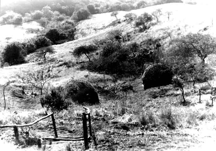
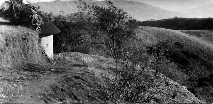
Zulu huts, Valley of a Thousand Hills, Natal.
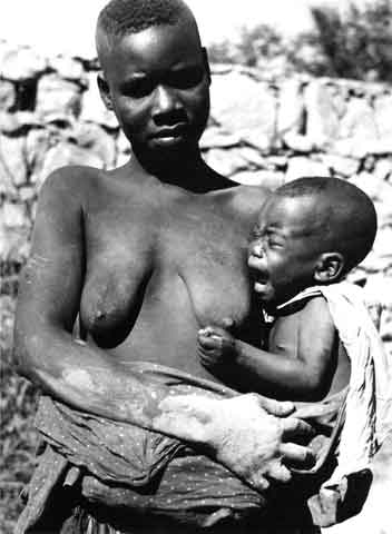
Zulu lass and howling brat - Eastern Provinces. KwaZulu-Natal also referred to as KZN or Natal) is a province of South Africa. Prior to 1994, the territory now known as KwaZulu-Natal was made up of the province of Natal and the homeland of KwaZulu. In the 1830s, the northern part was the Zulu Kingdom and southern part was briefly a Boer republic called Natalia (1839-1843). In 1843, the latter became the British Colony of Natal; Zululand (KwaZulu in Zulu) remained independent until 1879. It is called the garden province and is the home of the Zulu nation. Two natural areas: the iSimangaliso Wetland Park and the uKhahlamba Drakensberg Park, have been declared UNESCO World Heritage Sites. Located in the southeast of the country, the province has a long shoreline on the Indian Ocean. It borders three other provinces and the countries of Mozambique, Swaziland, and Lesotho. Its capital is Pietermaritzburg, and its largest city is Durban. (Thanks to Wikipedia).
JOHANNESBURG, SOUTH AFRICA
One of Johannesburg's shacks. Johannesburg also known as Jozi, Joburg, Joni, eGoli or Joeys, is the largest city in South Africa, by population. Johannesburg is the provincial capital of Gauteng, the wealthiest province in South Africa, having the largest economy of any metropolitan region in Sub-Saharan Africa. The city is one of the 50 largest metropolitan areas in the world, and is also the world's largest city not situated on a river, lake, or coastline. It claims to be the lightning capital of the world, though this title is also claimed by others. While Johannesburg is not one of South Africa's three capital cities, it is the seat of the Constitutional Court, which has the final word on interpretation of South Africa's constitution. The city is the source of a large-scale gold and diamond trade, due to its location on the mineral-rich Witwatersrand range of hills. Johannesburg is served by two international and one domestic airport. O.R. Tambo International Airport, the largest and busiest airport in Africa and a gateway for international air travel to and from the rest of Southern Africa is to the east of the city and Lanseria International Airport to the west. Rand Airport to the south east only handles general aviation flights, though it has the capacity for large jet aircraft. According to the 2007 Community Survey, the population of the city of Johannesburg was 4,434,827 and the population of the Greater Johannesburg Metropolitan Area was 7,151,447. A broader definition of the Johannesburg metropolitan area, including Ekurhuleni, the West Rand, Soweto and Lenasia, has a population of 10,267,700. The municipal city's land area of 1,645 sq km (635 sq mi) is very large when compared to other cities, resulting in a moderate population density of 2,364 /sq km (6,120 /sq mi). (Thanks to Wikipedia).
Johannesburg flats look like a dirty great mouth organ.
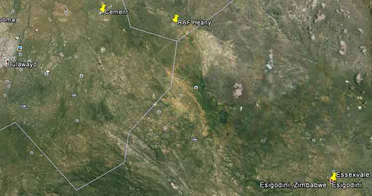
Essexvale - site of Officer Cadet Colin Jones's fatal Harvard crash in relation to Heany and Bulawayo. The region around Essexvale was, prior to the Matabele occupation, inhabited by the Rozi Moyo people, who had migrated from the territory around Gwanda and Belingwe. The township was founded in 1894 and originally consisted of an estate of nearly 200,000 acres. Frederic C. Selous, who contracted to guide the pioneer column to Mashonaland had an interest in the Company owning the estate, but left the country after fulfilling his contract. He returned in 1895, and took up residence on the estate. He erected a wire-wove house which he ordered from the United Kingdom, on top of a cliff 25 metres above the Ingnaima River. Selous was assisted by a young German, Herr Blocker, who was the forest officer on the estate. It was the Company's intention to plant large quantities of gum trees. During the Matabeleland Rebellion of 1896, Selous left the estate and assisted in quashing the rising, but during his absence the house was burnt down by Inxnogan, of the rebellious Matabele indunas. When the Rebellion was over, he wrote a book of his experiences, entitled "Sunshine and Storm in Rhodesia", and retired to England. The village is situated 37 km from Bulawayo by road and 47 km by rail on the Bulawayo-West Nicholson line. The area contains two gold belts on which there were several mines, the largest of which was the Bushtick. The main gold belt originates in the Filabusi district and runs through the estate in a northerly direction. The other, branches off near Balla Balla peak and runs west, terminating in the granites of the Bulalima district. Tungsten is also found in the area. The grass of the district, which was known as Godhlwayo is of an excellent quality, and the area supported large herds of Lobengula's cattle, who once said that the cattle of Godhlwayo were as many as locusts. Bulawayo receives its water supply from the Ncema dam which is situated on the estate. Before the establishment of Essexvale as a township, the Administrative centre was at Makukupen, which was opened as a police post in 1896. H. M. Jackson, who later became a Chief Native Commissioner was in charge. There was also a store which ran a postal agency and served the gold mine, which lay about a kilometre to the south east. Makukupen (meaning chicken) was the name of a headman who had his village at the foot of the Scoveni Hills, 7 km south-west of Essexvale. The Post Office was subsequently transferred to the farm, Widgeon, which was owned by Russell Brown. After his death, the agency was carried on by his wife for many years and when it was finally closed in 1965, it had been operated by the Brown's for a period of 37 years. The area consists of farms and ranches, and the countryside has very little natural timber. The area is well watered - nearly every farm having a perennial stream. The farms of the district are situated on a high plateau south of the Shashi River. Other rivers rising in the vicinity are the Devuli, Popotekwe, Mtelekwe and Umshagashi. The locality is on a gold belt and many small gold deposits have been discovered. South of the gold belt is situated a well known hill, called Zomo, which is fairly high and can be seen from afar. Like many other such hills in the country, it contains a number of ancient workings. The Welcome and Ilanga mines, situated 150 metres apart, were re-opened in 1960. (Thanks to Wikipedia).
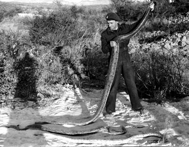
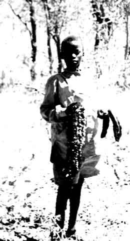
Luke with an 18 ft python and two smaller ones. These were killed near Essexvale presumably when investigating the fatal Harvard crash of Colin Jones. Harvard T.2 EX514 from 4 FTS struck overhead power lines and crashed on Thursday 19th July 1951. The pilot, Officer Cadet Colin Grosvenor Jones, was killed. (Thanks to Colin Cummings record of RAF accidents "Last Takeoff").
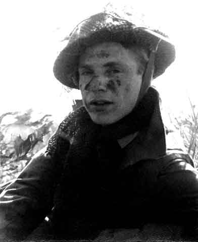
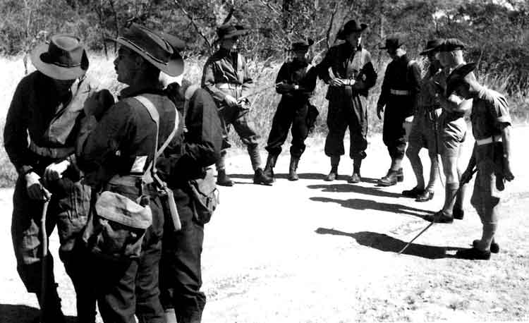
The day we were issued with "Big Hats".
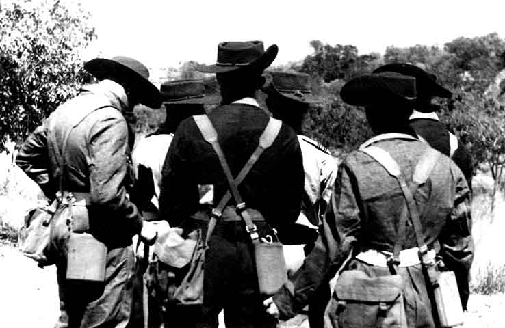
The hats in shape on "Bundu Bashing".
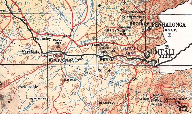
A map in the album that was presumably the area that the Course used for their "Bundu Bashing" - probably for jungle survival training. The white area on the right is Mozambique.
Species of African wild life.
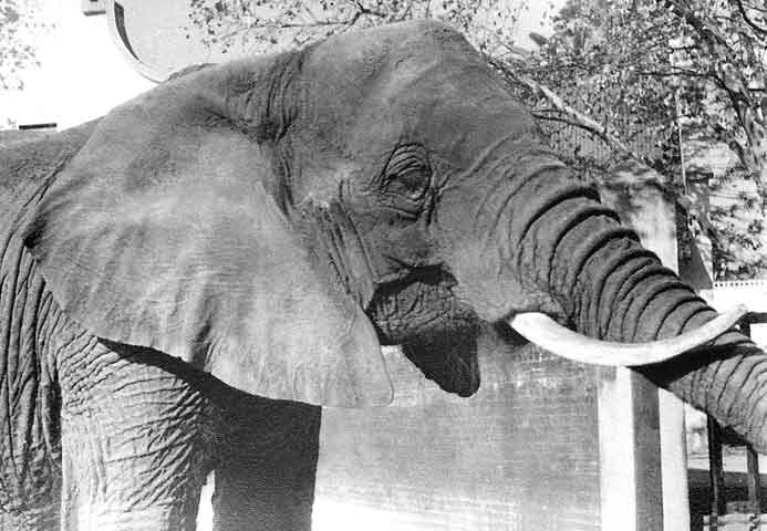
Moth-eaten old tusker - Pretoria Zoo.
'Nature Boy'.
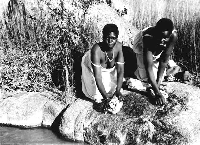
Getting that Persil whiteness!
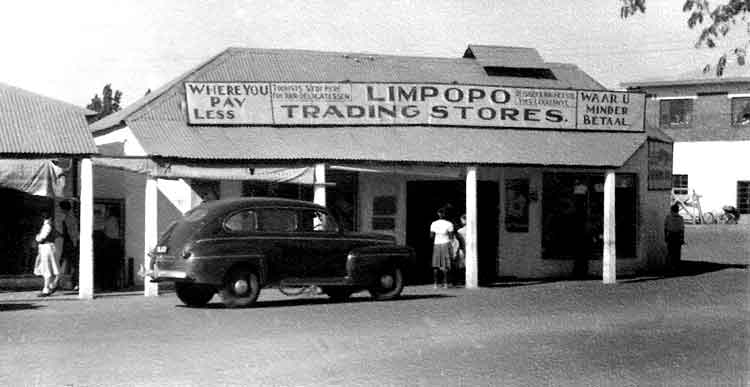
Village shop - Messina Transvaal. Musina or Messina is the northernmost town in the Limpopo province of South Africa. It is located near the confluence of the Limpopo River with the Sand River and the border to Zimbabwe. It has a population of between 20,000 and 40,000. Iron ore, coal, magnetite, graphite, asbestos, diamonds, semi-precious stones and copper are mined in the region. The Musina tribe discovered copper and settled here. In the 20th century European prospectors rediscovered the large copper deposits and established the town of Messina. The spelling of the name was changed to Musina in 2003 to correct the colonial-era misspelling of the name of the Musina people. The Limpopo River is a dry river bank which flows annually in rains when lichen and other plant species of the desert region come alive. Sometimes, it floods. The low-shrub and thorny tree lands that surround Musina and thrive in rains are alive with animals in sanctuaries that offer experienced-only camping safari accessible by sand and rock road tracks. Access is generally good, with the N1 road from Johannesburg through Musina northwards being wide tar, as are most other roads in the area. (Thanks to Wikipedia).
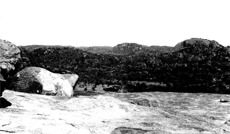
No place for forced landings! World's View, Matopas. The Matobo National Park forms the core of the Matobo or Matopos Hills, an area of granite kopjes and wooded valleys commencing some 35 kilometres south of Bulawayo, southern Zimbabwe. The hills were formed over 2 billion years ago with granite being forced to the surface, this has eroded to produce smooth "whaleback dwalas" and broken kopjes, strewn with boulders and interspersed with thickets of vegetation. Mzilikazi, founder of the Ndebele nation, gave the area its name, meaning 'Bald Heads'. The Hills cover an area of about 3100 sq km, of which 424 sq km is National Park, the remainder being largely communal land and a small proportion of commercial farmland. The park extends along the Thuli, Mtshelele, Maleme and Mpopoma river valleys. Part of the national park is set aside as a 100 sq km game park, which has been stocked with game including the white rhinoceros. The highest point in the hills is the promontory named Gulati (1549 m) just outside the north-eastern corner of the park. Cecil Rhodes, Leander Starr Jameson, and several other leading early white settlers, including Allan Wilson and all the members of the Shangani Patrol killed in the First Matabele War, are buried on the summit of Malindidzimu, the 'hill of the spirits' - this is a great source of controversy in modern Zimbabwe as this is considered a sacred place by nationalists and indigenous groups. This mount is also referred to as the World's View.
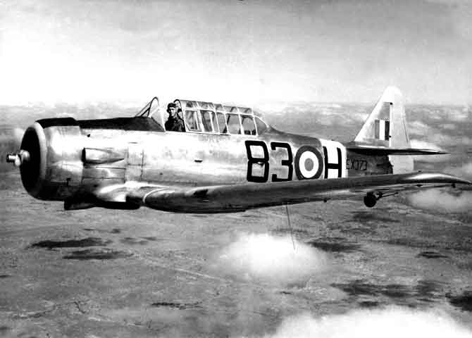
Solo formation flying with Johnny Hobbs in the Harvard T.2 EX373 - July 1951.
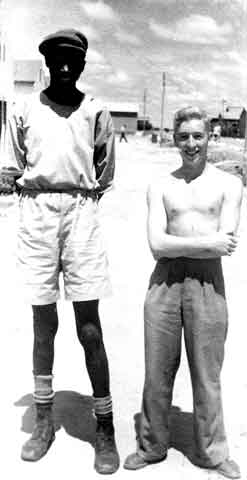
The Long and the Short }
}of it!
The Black and the White}
Awaiting the new detail.
BeBe trying to look as though it wasn't posed (much).
No 5 FTS RAF Thornhill Tower after their first "away" landing. L to R: Woody, BeBe, Frank Ted.
"Energetic Hunt".
'Ground School Day'.
"....now look here you dim..."
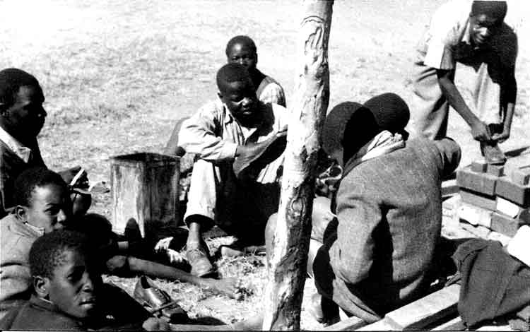
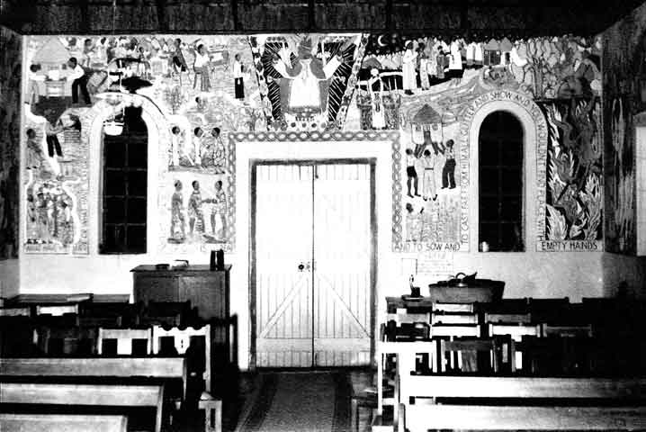
Canon "Ned" Patterson i/c Cyrene Mission. Cyrene Mission is a boys only High School situated outside Bulawayo near Westacre. The Mission was built in 1939 and named after Simon of Cyrene, who was forced to carry the cross at Jesus' crucifixion ( Luke 23:26 ). Canon Paterson, an Anglican priest born in Scotland but raised in Johannesburg, established the Cyrene mission near Bulawayo in the 1940s, and let his pupils make its mural paintings. It was the first time that Africans in Zimbabwe were given training in painting, and Paterson was convinced that only the lack of access had prevented Africans from reaching the same heights as European artists. Paterson later moved to Salisbury (Harare), where he without success tried to establish an art school in the largest township, Highfield.
(Thanks to School web site).
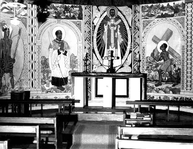
The Alter in the Cyrene Chapel - August 1951. The chapel remains as a living memorial of an earlier era. Its many murals mirror the artists' environment, with Matobo rocks and rural kraals in the background. They are unique, and visitors come from all over the world to view them. The chapel was declared a National Monument in 1987. However, it is much more than a monument. Mass is celebrated here daily, and during school holidays a small congregation meets each Sunday morning for worship.
(Thanks to Cyrene Mission web site).
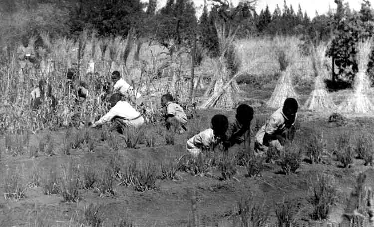
The gardening lesson at the Cyrene Mission.
Shoe repairs.
Back to school.
Kathleen Paterson and son.
Father, son and little lamb.
The west end of the Chapel at Cyrene.
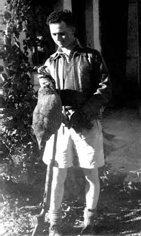
About the only one that didn't get away from BeBe.
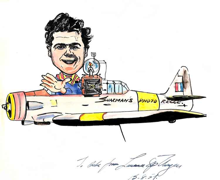
Thayer takes the Mickey(at an honest attempt to make the odd penny.) Signed: "To BeBe from Laurence P Thayer - 15.8.51".
Angels twelve above the Bundu - Johnny Hobbs on solo formation.
Larry Thayer working on the mural in the bar.
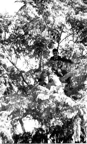
BeBe's fellow "fugitive" in foxhole.
"Bundu Briefing".
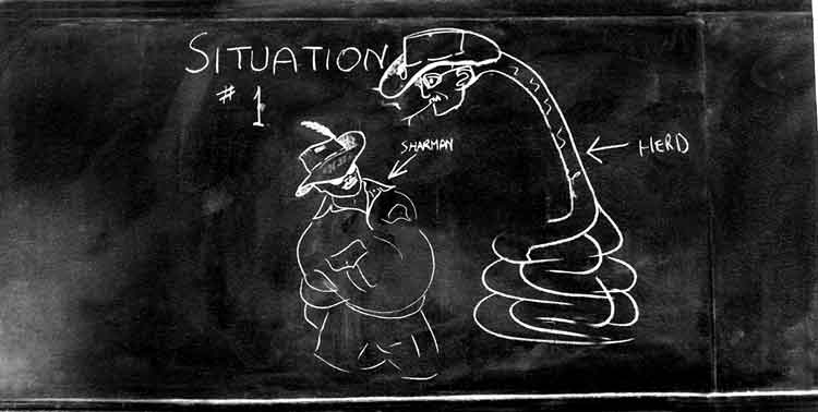
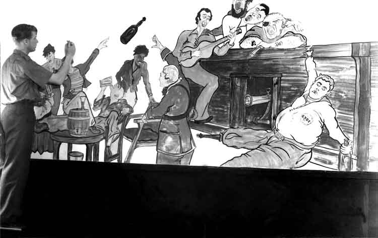
Found on a classroom blackboard.
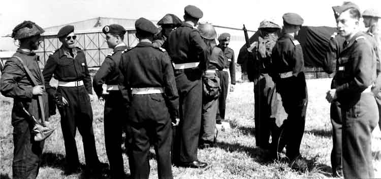
After lunch, - "T.E.W.T." at Matopas.
"Situations on a T.E.W.T."
Not discussing politics.
Jock - dejected - even from the back.
Beads - two tickies.
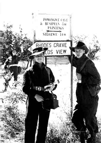
Tourist signpost - Thayer and Sharman (and a very rude cadet behind).
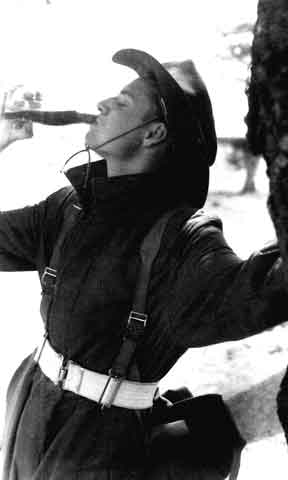
Hey! Save some for me.
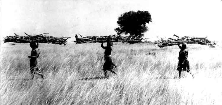
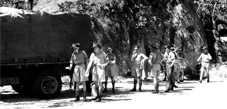
"Bundu train."
SOUTHERN RHODESIA
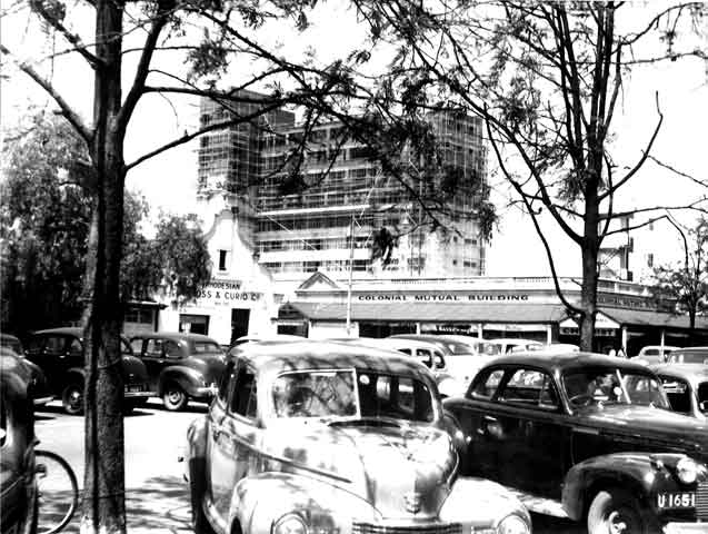
Growing Bulawayo.
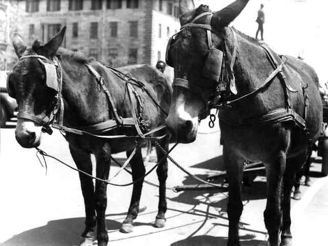
Still used for transport here.
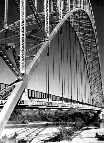
Birchenough Bridge - Eastern Province. Birchenough Bridge is the name for both a bridge across the Save River and a village next to the bridge. Birchenough Bridge is called after Sir Henry Birchenough. Birchenough Bridge is located 62 km from Chipinge in the Manicaland province of Zimbabwe linking Mutare with Masvingo. The bridge was funded and planned by the Beit Trust, a foundation chaired at the time by Sir Henry Birchenough whose ashes are buried beneath the structure of the bridge. Ralph Freeman, the bridge's designer, was also the structural designer on the Sydney Harbour Bridge and consequently the two bridges bear a close resemblance, although Birchenough is only two-thirds as long as the Australian bridge. It was built by Dorman Long and completed in 1935. At a length of 1,080 feet (329 m) it was the third longest single-arch suspension bridge in the world at the time. In the 1970s a 40-tonne load limit was imposed on the bridge but in 1984 the bridge was widened (roadway: 7.2 m to 10 m wide) and strengthened as part of the World Bank's Highway Project One. The village which sprang up next to the bridge has become the centre of a small-scale farming area. The bridge is widely considered by Zimbabweans as being one of the country's finest pieces of engineering, and as such, it appears on the twenty-cent coin. It's the only bridge without any piers or supports on the bottom holding it for its support. Due to economic turndown and a political storm from the year 2000 the Zimbabwe Department of Roads has reduced its load capacity not to allow any vehicle weighing more than 25 tonnes. This had reduced business activities in the areas nearby since heavy vehicle trucks will not be allowed to cross the bridge.
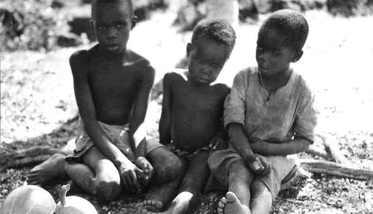
Just like kids at home.
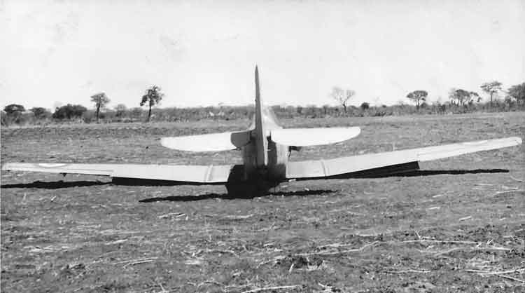
The result of steering a bearing! Withey's forced lob. [No records of an accident so aircraft must have been recovered with less than Cat 3 damage.]
The best portrait yet taken of O/C Woodward.
Geography book type photo.
Shall I? (Langley all worried).
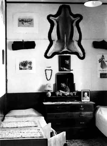
The room of Langley and Sharman. (Langley in the mirror.)
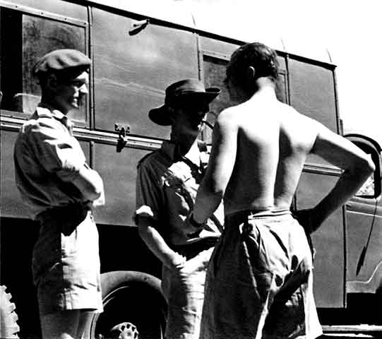
Well, so that's the reason! (This was taken without my knowledge - and published without my permission - S. P. Thayer).
Clothing coupons a bit short?
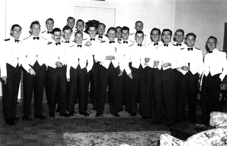
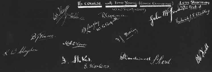
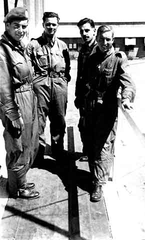
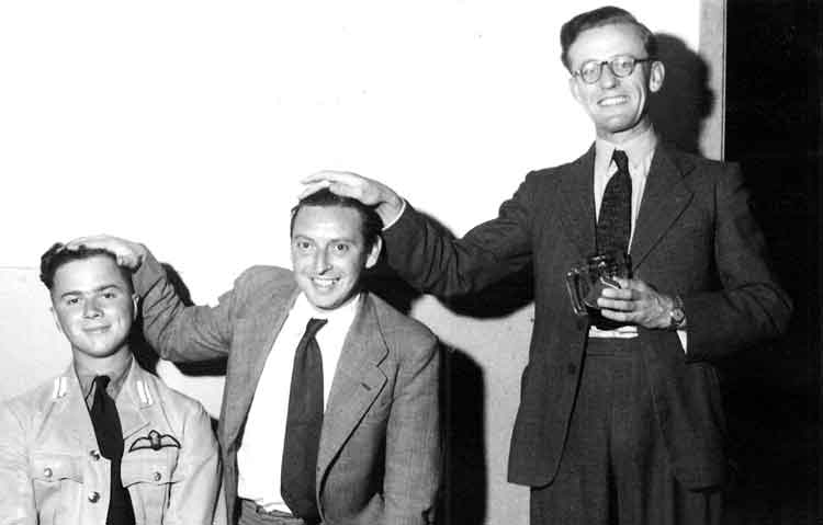
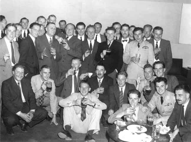
16 Course with Tony Young (Course Commander) - (Less Sharman who took it) - Dining In Night 18Oct51.
[Not clear whether signatures are in the same order and place as their owners?]
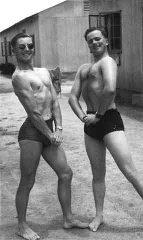
Muscle bound monsters at Heany.
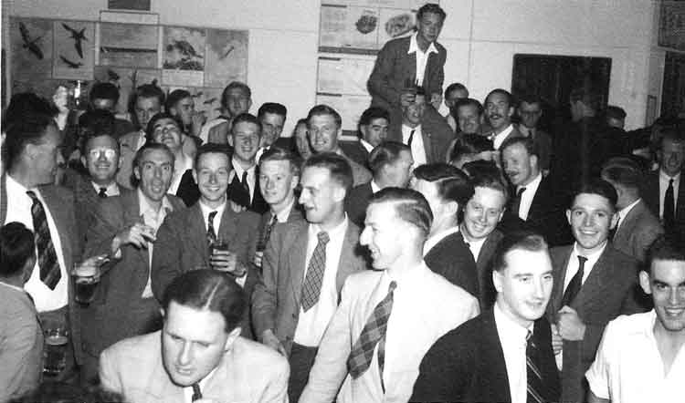
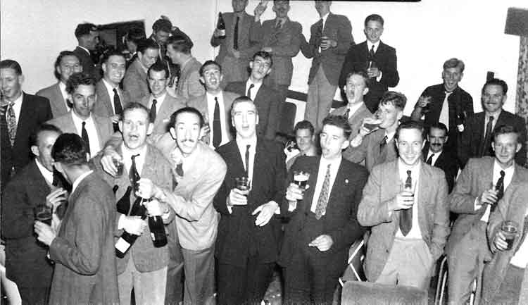
15 Course Pass Out Party.
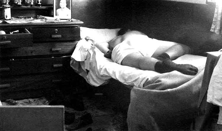
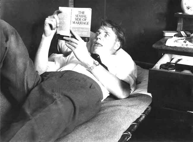
Langley - the morning after!
Formation with "Woody".
3 generations of pilots. L to R: Self, Harry Bridge (My instructor) and Roy Parsons the Adj. ( Harry Bridge's instructor).
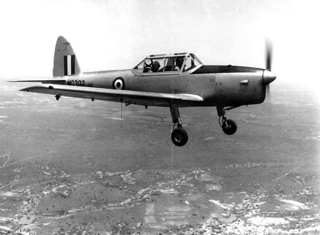
The first Chipmunk at Heany.
Expressions!!
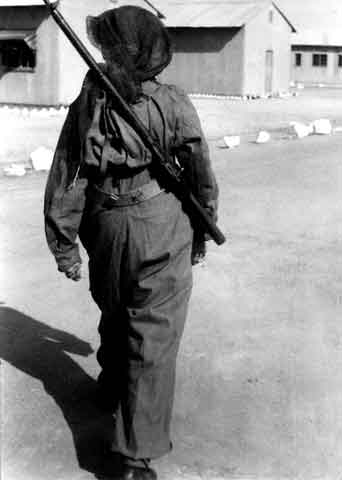
Old Man Dodd prematurely sewing.
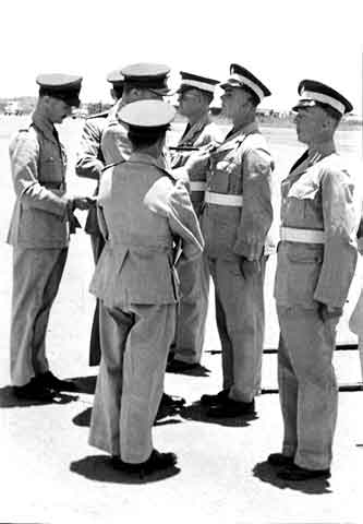
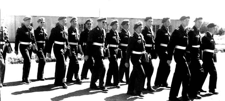
Wings Parade - Nov51.
End of Course Session - Nov51
THE JOURNEY HOME AFTER THE AWARD OF WINGS - NOV51
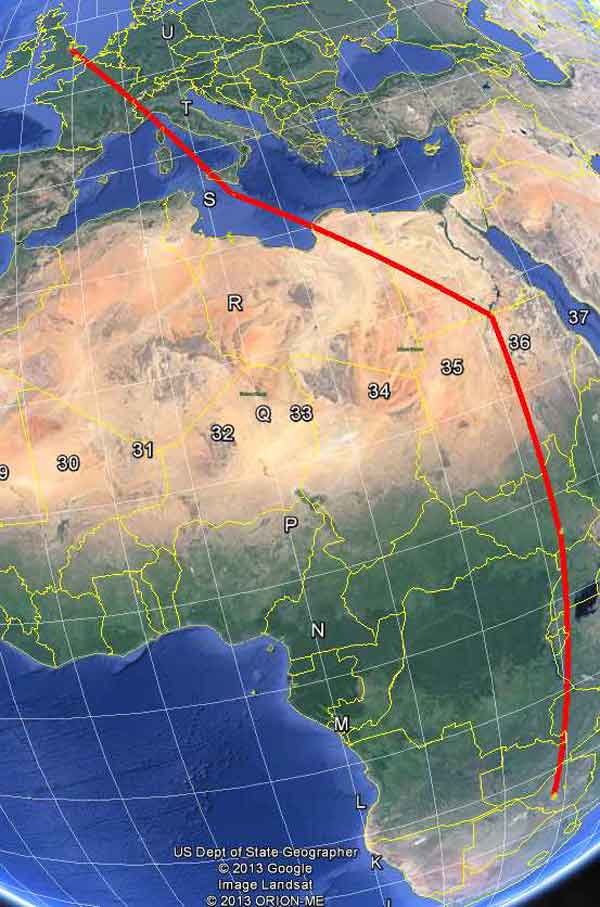
Route Home by Dakota.
Last View of Heany, S. Rhodesia.
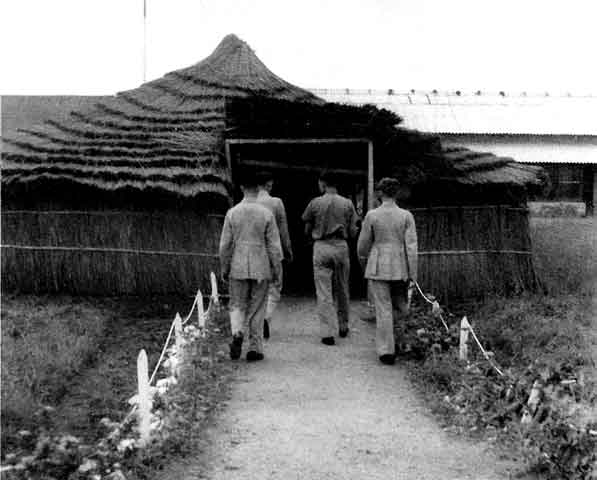
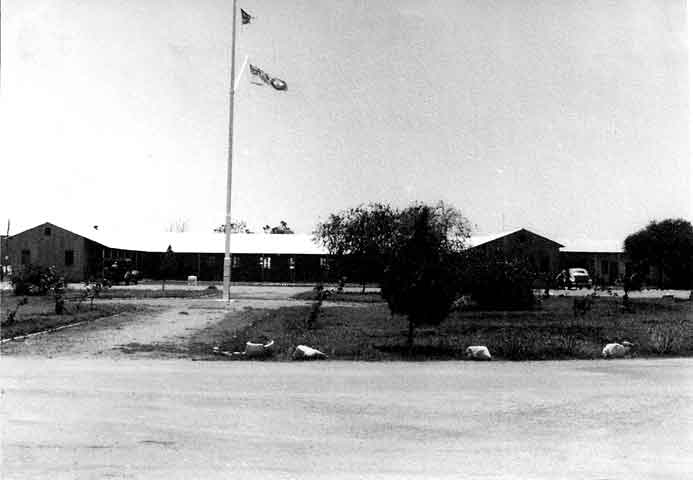
Air Force Reception Building at Juba.
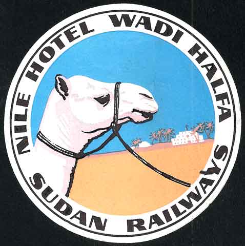
Nile Hotel, Wadi Halfa, Sudan Railways.
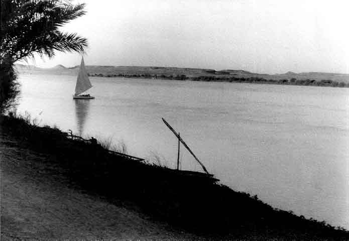
The Nile at Wadi Halfa.
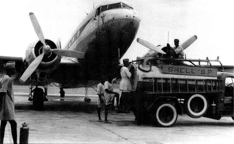
Refuelling "Saint Hellier" at Juba. Bebe returned to UK and was held at No 5 Personnel Despatch Centre Lytham St Anne's from Nov51 to Feb52. He was then sent to No 7 FTS at RAF Cottesmore from Feb52 until Apr52.
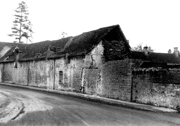
A Scene in Cottesmore Village.
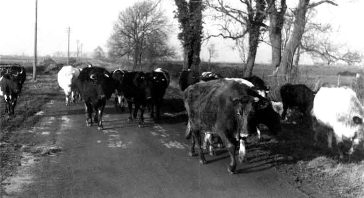
On a Sunday Afternoon.
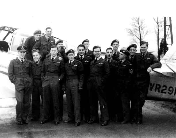
The "Rhodesian Refresher Course" at No 7 FTS RAF Cottesmore - Feb52 to Apr52.
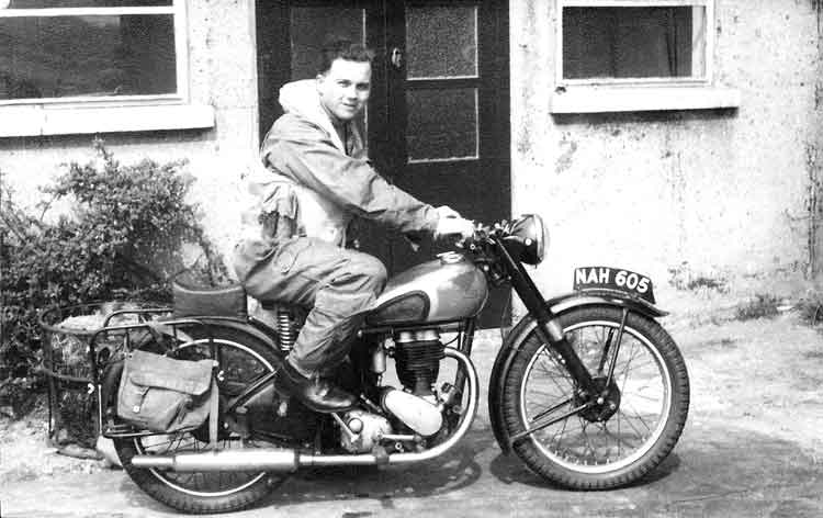
BeBe and his Motorcycle.
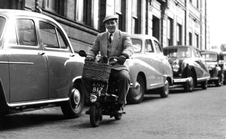
...and on his moped
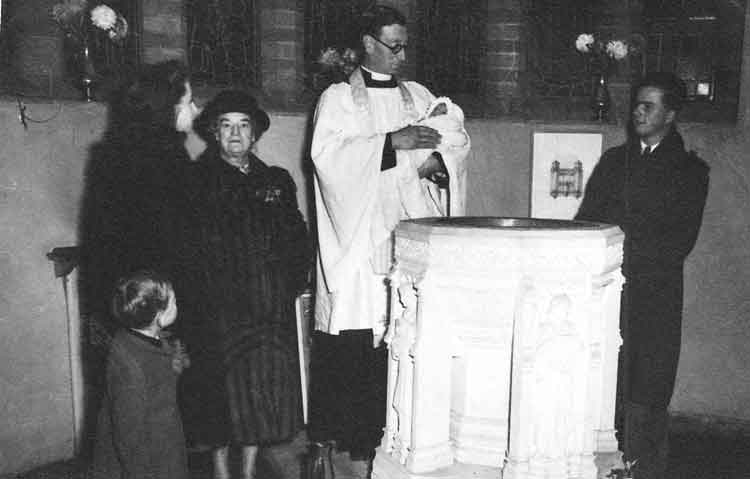
...and on the right at a christening
Bebe went from Cottesmore to 215 Advanced Flying School at Finningley from April 1952 until July 1952. He then did the 229 Operational Conversion Unit Course at RAF Chivenor where he converted on to Venoms before being posted to 98 Sqn at RAF Fassberg in Germany in September 1952.
(Thanks to Mamie Sharman and many quotations from Wikipedia.)
(
Click to go to Album 4.)